Sustainable development – definition, concepts and philosophy
Sustainable development was first described as, the “development that meets the needs of the present without compromising the ability of future generations to meet their own needs”. (Brundtland 1987).
Sustainability is a model for future in which environmental, social and economic considerations are balanced in development activities. It includes an improved quality of life as well. Sustainable development is a way within which many processes and pathways to achieve sustainability say, sustainable agriculture, sustainable production and consumption, good government, research and technology transfer, etc (Unesco 2013).
The Rio Declaration (Earth Summit) contains 27 principles, including:
- People are entitled to a healthy and productive life in harmony with nature;
- Eradicating poverty and reducing disparities in living standards in different parts of the world;
- Environmental protection is an integral part of the development process and cannot be considered in isolation from it.
These principles can guide the efforts of governments, communities and organizations to define sustainability goals and create programmes to help achieve those goals. In addition to these, global sustainability dialogues includes the following principles as well:-
- A systems thinking approach, rather than an approach that looks at problems in isolation should be used. Sustainability issues are linked and part of a “whole.” (Systems thinking is the process of understanding how elements of a system influence one another within the whole.)
- Understanding local issues in a global context and recognizing that solutions to local problems can have global consequences.
- Considering differing views before reaching a decision or judgment.
- Emphasizing the role of public participation in community and governmental decision-making. People whose lives will be affected by decisions must be involved in the process leading to the decisions.
- Calling for greater transparency and accountability in governmental decision-making.
After the Earth Summit in 1992, governments and communities were charged with the responsibility of creating sustainability plans. Governments and civil society must identify priorities and create their own sustainability goals. Then, they can create plans to achieve those goals. Ideally, at local level, every community would include sustainability in its plans and projects. It is the responsibility of all sectors of society to work towards a more sustainable future (Unesco 2013) .
Legal obligations to have scientific and planned activities
Village panchayats are local governments with powers inherited from the constitution and which have functions with direct effects on the environment and on the people who live within their geographical jurisdiction. As laid down in the Kerala Panchayat Raj Act 1994: Section 162.A, the standing committee for development is responsible to carry out the development planning, socio-economic planning, spatial planning etc, with some other responsibilities. The standing committee for health and education is responsible for environmental protection in village panchayat levels. Grama Sabha has the powers to formulate schemes to impart awareness on matters of public interest like cleanliness, environmental protection, pollution control etc. Village panchayats also have the general function to Inculcate environmental awareness and motivating local action for environmental upgradation.
As laid down in the Mahatma Gandhi National Rural Employment Guarantee Act, 2005 Section 16. (3), every Gram Panchayat shall, prepare a development plan and maintain a shelf of possible works to be taken up under the Scheme as and when demand for work arises. Under this act, Village Panchayats need to prepare a watershed based master plan, as detailed in Watershed Works Manual published by the Ministry of Rural Development, GOI. It’s two chapters: 5. Mapping and 6. Technical Surveys of a Watershed, details the techniques of mapping.
The Common Guidelines for Watershed Development Projects of Government of India, 2008 also details two entire chapters about the need of Technology inputs and GIS while preparing plans: Chapter 2. Guiding Principles – V. Capacity Building and Technology Inputs: Current trends & advances in IT & Remote Sensing and Chapter 3. Technology Inputs – Core GIS facilities, DPR – Resource Maps, Cadastral maps etc.
The Kerala Town and Country Planning Act, 2016, which is enacted for the promotion of planned development and regulation of growth of urban and rural areas in the state with focus on scientific spatial planning and to secure to their present and future inhabitants, sanitary conditions, amenity and convenience and for other matters connected therewith. It makes the village panchayat into a local planning area, and Section 30 of the act mandates the panchayat to develop a master plan, execution plan and a detailed town planning scheme. A master plan (section 34) is a comprehensive plan for a local planning area, conceived within the framework of the district level perspective plan, providing long-term policies, programmes and detailed proposals for spatial development of the use of land and development etc. An execution plan (section 37) is prepared for a period of five years for the local planning area providing the goals, policies, strategies, priorities and programmes for spatial development of the area for the period. A Detailed Town Planning Scheme (section 44, 45) is a comprehensive plan for a particular area within the local planning area, conceived within the framework of the master plan for the local planning area, providing detailed proposals for spatial development in which the use of land and development shall be carried out.
It should be noted that, state government issued a circular to constitute “Sevagram” Gramakendram, and an order is issued framing the detailed work chart of them. It is an extension centre of Village Panchayat in each ward, important statistics, various maps (political, resource, social, drainage, land use) relating to that ward should be displayed for public information. There is a need of maps depicting ward-level details.
In case of the Saansad Adarsh Gram Yojana (SAGY), which was launched by the Prime Minister Sri. Narendra Modi, each member of the parliament can adopt two of the village panchayats in his/her constituency for this programme. It is a rural development programme focusing upon the all-inclusive development of the village panchayats. Para 10 Planning – of the guidelines for SAGY requires to prepare Social Map, Resource map, maps showing Land Use, Water bodies, Irrigation Structures, Physical layout of the land – showing slopes, undulations, drainage patterns etc through participatory approach. It also requires the data collected through the situation analysis should be captured on a GIS platform. Para 13. Use of Technology & Innovations – of the guideline encourages the adoption and adaptation of technology and introduction of innovations in this programme. One among them is (i). Space applications and remote sensing, which will be used in the planning and monitoring of the programmes. Assets will also be mapped using GIS.
So the three tier panchayats are in a phase, seriously stepping onto the field of scientific spatial planning. All the above acts, guidelines etc. mandates the need of scientific spatial planning at the village panchayat level. It is high time to use GIS and remote sensing techniques, and immensely use the geospatial data while preparing plans.
Business Process Reengineering (BPR)
(Hammer and Champy 2009) define business process reengineering (BPR) as ‘the fundamental rethinking and radical redesign of the business processes to achieve dramatic improvements in critical, contemporary measures of performance, such as cost, quality, service and speed’. The routine business process in the administration of village panchayats should be optimised so as to improve the overall performance and increase the quality of service. In addition to it, an optimised software based framework should also be developed to achieve this goal.
A technological framework for sustainable development
Even with the presence of an e-governance initiative by the government, almost all of the mandatory and statutory functions of the village panchayats in the state are carried out in an archaic manual decision making process, with less use of intuitive technological support. As a result, most of the obligations village panchayats are entitled, as per the Bruntland Commission Report, Rio Declaration (Earth Summit) and global sustainability dialogues are not efficiently followed.
But many of the insights to follow these obligations can be achieved by the effective integrated use of techniques namely Enterprise Resource Planning (ERP), Remote Sensing and Geograhical Information Systems, Content Management System (CMS) and Business Intelligence (BI).
ERP – holistic approach.
We are moving through an era in which software development activities for e-governance and local administration is done adopting Enterprise Resource Planning (ERP) principles (Pune Municipal Corporation 2016). ERP is a business process management software that allows an organization to use a system of integrated applications to manage the business and automate many back office functions related to technology, services and human resources. It integrates all facets of an operation, including product planning, development etc. (Beal 2016). In other words, the term ERP stands for the idea of all the information and operations needed for an enterprise is coordinated in a computer system with the help of hardware and software. For making this coordination easier, besides computer software and hardware, a unified database also is used storing and managing the different activities of the institution. In short, an ERP software is a system which contain a unified database which store and manage the details of activities, a common computer application which manage the day to day activities, and a unified user interface.
GIS or Geographic Information System
We can define a geographic information system as a computerised system that facilitates the phases of data entry, data analysis and data presentation especially in cases when we are dealing with geo-referenced data. A geographic information system (GIS) is a computer system for capturing, storing, checking, and displaying data related to positions on Earth’s surface. GIS can show many different kinds of data on one map. This enables people to more easily see, analyse, and understand patterns and relationships (National Geographic Society 2011).
Content Management System
A content management system (CMS) is a computer application that supports the creation and modification of digital content using a common user interface and thus usually supporting multiple users working in a collaborative environment. It is possible to store, share and contribute information for a large number of people via this system.
Business Intelligence
Business Intelligence (BI) can be described as “a set of techniques and tools for the acquisition and transformation of raw data into meaningful and useful information for business analysis purposes” (Turner 2016). There are BI softwares available, which can be used for acquiring better insights on the stored data using ERP, GIS and CMS. This will give more precision in the mandatory activities of village panchayats.
FOSS for Local Governments
Free software: Free software is “that comes with permission for anyone to use, copy, and distribute, either verbatim or with modifications, either gratis or for a fee”(‘Gnu.org’ 2016) and essentially the source code of the software is available.
Open source software: As per the open source initiative, “Open source is a development method for software that harnesses the power of distributed peer review and transparency of process. The promise of open source is better quality, higher reliability, more flexibility, lower cost, and an end to predatory vendor lock-in” (‘The Open Source Initiative’ 2016).
In common practice, Free, Open source and allied classes of softwares are grouped as one, and referred to as Free/Libré/Open Source Software and abbreviated as FLOSS or FOSS. The active user communities and developer communities around the globe are peculiar for this group of software. The community culture and the democratic decision making process in the FOSS domain has similarities with the decision making process in village panchayats.
Integrated software for Panchayat / Local Administration
In case of panchayats, the advantage of adopting a FOSS based ERP software is that, all the activities notably production, purchase, distribution, collection, human resources, financial affairs, project management, customer relations, assets, etc can be coordinated through a single computer application. For eg, the related activities like building permission, basic tax assessment, basic tax collection, etc can be connected through information sharing by ERP. When building permission is issued, the information will be available in basic tax collection wing.
ERP has a relational database. A change in any record, will be available at once in all parts of the system. All the activities of the integral institutions of a village panchayat can be coordinated through ERP, which is not available in the present software programmes. When an employee login to the ERP, all his/her duties will be listed in that single interface. This will reduce the time taken for doing a specific duty, and will increase accessibility.
In village panchayats, the activities like building regulation, tax collection, licensing resource management, project planning, waste management, agriculture etc are having a spatial component. To manage these kind of spatial activities, a GIS component also can be planned with the ERP software. For eg, the zoning of basic tax assessment can be made available in GIS. If the information which are collected and stored using ERP and GIS is disseminated via web content management system (CMS), the legal obligations due to the section (4) of the Right to Information act can be satisfied easily.
In the free software domain, there are software frameworks and software programmes are available, which are customisable for satisfying the needs of village panchayats.
In village panchayats and in their integral institutions and in the department of panchayats, a FOSS based integrated and centralised software system should be deployed, which essentially having an ERP, a GIS, a CMS, and a BI and data visualisation component. Free and Open Source Software must be given priority, as those will be the sustainable solution for long-term use.

Schematic diagram
Accounting, Budget, Income and Expenditure, Human Resource Management, Project Management, Construction, Meetings, Purchases, Collaborative file management etc can be managed using ERP. Assets, Taxation, Licensing, Land and Water Resource Management, Building rules, Data bank of wetlands and paddy fields, etc can be managed using GIS. Online distribution of various certificates, information dissemination, publication of notices, consolidation of acts, rules, orders, circulars, guidelines etc can be managed using CMS. The CMS can be configured as the tender notices, notifications, project plans, biodiversity registers etc can be published in a decentralised manner from the concerned offices respectively. The information and statistics which are consolidated in this integrated software can be arranged such as those are published automatically, satisfying the section 4 of the RTI Act. A Search Engine Optimisation (SEO) also need to be done for better information dissemination. BI can be generated from the data and information stored in the ERP, GIS and CMS components of the integrated software system.
Existing free and opens source software tools and frameworks can be customised for developing this integrated software system. This approach have many advantages, over the traditional method of developing the software programme from the scratch:
- No need of computer servers at the village panchayats, only client computers are needed there. Servers can be deployed only at state level data centre. All the components of the integrated software can be installed at the server in the State data centre. Mirror sites can be used for controlling the traffic in the servers. All the updates can be done only in the centralised server. The overall activities can be monitored in centralised as well as de-centralised manner. It is more easy to manage.
- No need to develop the generic components like database management, user interface, printing module etc, as, those are included in those frameworks themselves.
- Existing software frameworks in these fields are international projects, and using these software frameworks, customisation and developing modules to satisfy our specific needs, interacting with the developer teams etc will increase our teams capacity and quality. It will bring professionalism in the work as well.
Reference
- ‘About the Open Source Initiative’. 2016. Open Source Initiative. Accessed July 8. https://opensource.org/about.
- Beal, Vangie. 2016. ‘What Is Enterprise Resource Planning (ERP)? Webopedia Definition’. ERP – Enterprise Resource Planning. Accessed July 8. http://www.webopedia.com/TERM/E/ERP.html.
- ‘Detailed Project Report for ERP Based E-Governance at Pune Municipal Corporation’. 2016. Accessed July 8. http://www.punecorporation.org/informpdf/PMC_DPR_ver8.0.pdf.
- ‘Education for Sustainable Development: Sourcebook; Education for Sustainable Development in Action: Learning & Training Tools; Vol.:4; 2013 – 926unesco9.pdf’. 2016. Accessed July 1. https://sustainabledevelopment.un.org/content/documents/926unesco9.pdf.
- ‘Gnu.org’. 2016. GNU Operating System. Accessed July 8. https://www.gnu.org/philosophy/categories.en.html.
- Hammer, Michael, and James Champy. 2009. Reengineering the Corporation: Manifesto for Business Revolution, A. Zondervan.
- National Geographic Society. 2011. ‘GIS (Geographic Information System)’. National Geographic Society. March 26. http://nationalgeographic.org/encyclopedia/geographic-information-system-gis/.
- ‘Our Common Future: Report of the World Commission on Environment and Development’. 2016. Accessed July 1. http://www.un-documents.net/our-common-future.pdf.
- Turner, Dawn M. 2016. ‘What Is Venture Management?’ Blog. VentureSkies. February 19. http://www.ventureskies.com/blog/what-is-venture-management.

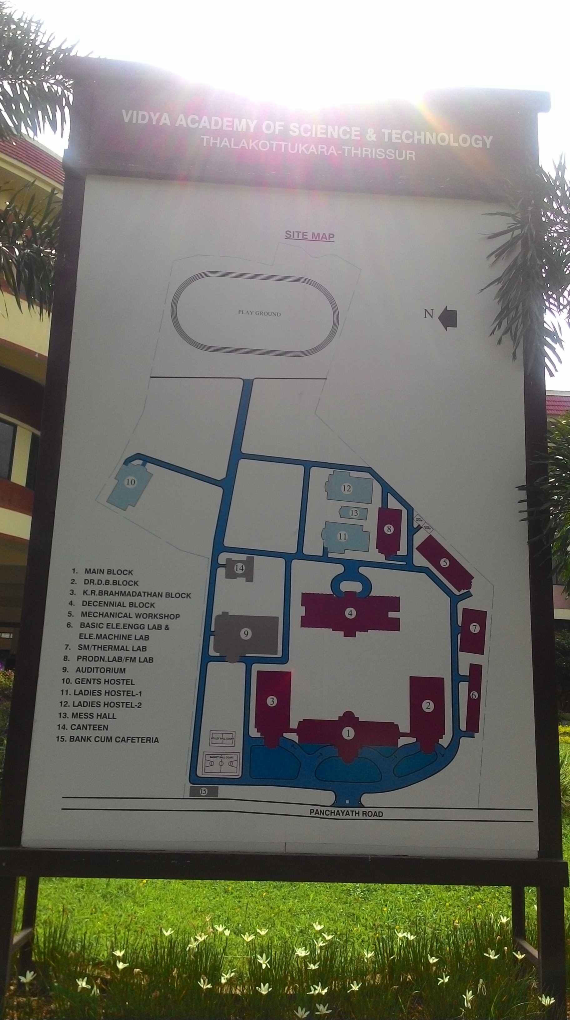
 PDF copy of this map is available here:
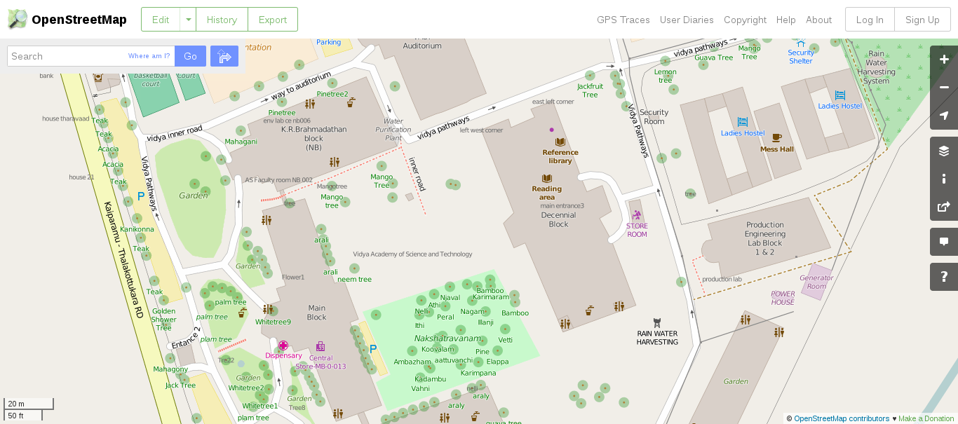